


![]()
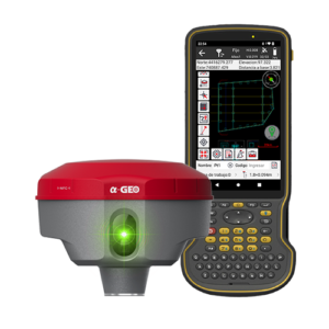
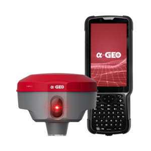
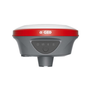
AlphaGEO Matrix VI
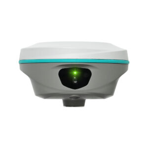
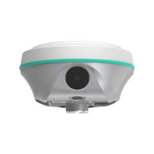
GPS receiver (GNSS) with laser meter and two cameras (Visual 3D + AR Stakeout)
- Powerful green laser, with recording of the X,Y,Z coordinates of the measured point in any orientation and inclination. Assisted by front camera. This new laser is visible even on very sunny days.
- 3D visual survey via front camera (3D model acquisition by taking photos or videos)
- Visual stakeout via bottom camera, with Augmented Reality (AR)
- Super IMU up to 120° tilt, no calibration necessary
- Lightweight (800g)
- 7 constellations and 1,408 channels
- RTK, PPK and PPP
- Robust FIX connection in challenging environments (under trees, urban environments, near tall buildings)
- Tx/Rx radio (compatible with major brands), Wifi, 4G, NFC and Bluetooth
- SurPro Professional Field Application (Free, for installation on smartphone / Android controller)
- Up to 15 hours battery life
- IP67 protection (withstands drops of up to 2 m in height)
Best price, guaranteed!!!
Description
Topographic GPS receiver with integrated green laser meter + Camera for photogrammetric visual survey + Camera for image-assisted stakeout. Alpha GEO (a-GEO) Matrix VI.


Specifications
PERFORMANCE
| Satellites | GPS: L1, C/A, L2C, L2P, L5
GLONASS: L1, L2 BEIDOU: B1, B1C, B2, B2a, B2b, B3 GALILEO:The/E5a/E5b/E6 QZSS; L1/L2/L5/L6 SBAS: WASS, EGNOS, MSAS, GAGAN, SDCM |
| Channels | 1408 |
| Cold start | <60 s |
| Quick start | <15 s |
| Positioning output speed | 1 Hz - 50 Hz |
| Signal recapture | 1 s |
| RTK initialisation time | 5 s |
| Reliability of supply | 99,99% |
| Accuracy in time | 20 ns |
POSITIONING
| Differential solution | Horizontal 0.25 m + 1 ppm, Vertical 0.5 m + 1 ppm |
| Static accuracy | Horizontal 2.5 mm + 0.5 ppm, Vertical 5 mm + 0.5 ppm |
| RTK accuracy | Horizontal 8 mm + 0.5 ppm, Vertical 15 mm + 0.5 ppm |
PHYSICAL CHARACTERISTICS
| Material | Magnesium alloy |
| Size | 129 mm * 79 mm (+ 20 mm bottom mounting) |
| Weight | 0,80 kg |
| Operating temperature | From -40 °C to 75 °C |
| Storage temperature | From -50 °C to 85 °C |
| Protection | IP67, protected against immersion for 30 minutes to a depth of 1m |
| Impact | Withstands falls from a height of 2 metres onto concrete |
| Vibration | MIL-STD-810G |
| Humidity | 100% Moisture resistance |
BATTERY
| Fast charging | Yes |
| Duration | 12 hours in rover mode, 7 hours in base mode, 15 hours in static mode |
| Type | Lithium-ion battery (7.4V - 7000mAh) |
PHYSICAL COMMUNICATIONS
| Port LEMO | 5 pin |
| USB Type-C | Upload / Data transfer |
| SIM | Nano-SIM support |
| Antenna port | UHF-SIM interface |
WIRELESS COMMUNICATIONS
| Radio: Transmission power | 1-1.5 W, switchable |
| Radio: Frequency range | 410-470 MHz, with the ability to set frequency |
| Radio: Protocols | TrimTalk450s, Alphatalk15, South, Satel, PCC-EOT |
| 4G modem | Built-in 4G full-frequency multi-band full-frequency modem, supporting WCDMA/CDMA2000/TDDD-LTE/FDD-LTE |
| WIFI | 802.11b/g, access point and client mode (hotspot support) |
| Bluetooth | Bluetooth V5.2 Classical / BLE Proprietary dual mode |
DATA FORMAT
| Differential data | RTCM 2.X, RTCM 3x, CMR and CMR+, SCMRX |
| Output data | RINEX, NMEA-0183 |
STORAGE
| Memory | 64 GB of internal storage, supports cyclic storage, with the ability to collect raw observations for 4 years based on a 5-second interval |
LASER
| Colour / Class | Green / Class 1 |
| Accuracy | 1cm + 5mm/m |
CAMERAS
| Camera 1 (AR) | 5 Mpx HD camera with wide viewing angle and live panning support |
| Camera 2 (Laser Assist + Visual 3D) | 2 Mpx / FOV: 84º. |
OTHER CHARACTERISTICS
| Operating system | LINUX |
| Tilt compensation | IMU up to 120° (4D IMU - 400Hz) |
| Compatible controllers | All Android devices |
DESIGN
| Button | 1 * Power button |
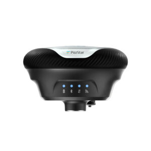
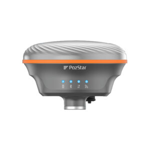
| Indicators | 1 * Power Indicator, 1 * Bluetooth Indicator, 1 * Data Indicator, 1 * Satellite Indicator |
| Voice | Intelligent voice prompts |
| Web interface | Compatibility with WEBUI configuration |
Related products
-
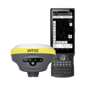
Marvel Lite + T6
1.599,00 € View product -
Matrix II Laser + S60III
View product -
Reno2 3D + H6
3.250,00 € View product -
V1 + H6
2.340,00 € View product -
Matrix II Laser + S50III
View product -
AlphaGEO L100
1.490,00 € View product -
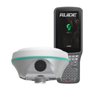
Ruide Rama2 Laser + Visual 3D
3.500,00 € View product -
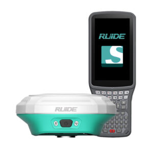
Ruide Reno2 Visual 3D
2.850,00 € View product -
PozStar P5
View product -
PozStar S5
2.280,00 € View product